Property Line Survey
Property Line Survey
Territory Surveys Pty Ltd is known for its team of diverse professionals who assess and provide expert guidance on land, building, and property matters, ensuring informed decisions and accurate results.
Our Mission
To provide accurate, efficient, and honest surveying services that support landowners, builders, and developers across the Northern Territory. We’re here to simplify the complex, deliver on time, and help projects move forward with confidence.
Our Vision
To be the NT’s most trusted survey team, known for our local knowledge, dependable service, and hands-on approach in even the toughest environments.

Accuracy and Reliability
Territory Surveys Pty Ltd is known for its team of diverse professionals who assess and provide expert guidance on land, building, and property matters, ensuring informed decisions and accurate results.
Surveying Expertise
Our team works closely with contractors and engineers to keep projects on schedule and within tolerance. Whether it’s a complex structure or remote civil works, we bring the technical skill and site experience to deliver results you can build on.


Residential
We assist homeowners, builders, and developers with accurate site measurements, boundary surveys, and construction setouts, ensuring precision and compliance with regulations.
Commercial
Our team provides exact surveying solutions for commercial projects, including retail, office, and industrial developments, delivering reliable results that support successful project outcomes.
Government
We collaborate with local and state government agencies, offering dependable data and mapping services for infrastructure planning, development, and public works initiatives.
"Your Vision, Our Precision"
Expert knowledge of the NT landscape.
Dedicated to delivering reliable results.
Committed to excellence at every stage.
ABOUT US
Territory Surveys Pty Ltd
Territory Surveys Pty Ltd is a trusted and professional land surveying company, proudly locally owned and operated in the Northern Territory. With a deep understanding of the region’s unique landscape and regulatory requirements, the team offers expert surveying services tailored to meet the specific needs of clients.
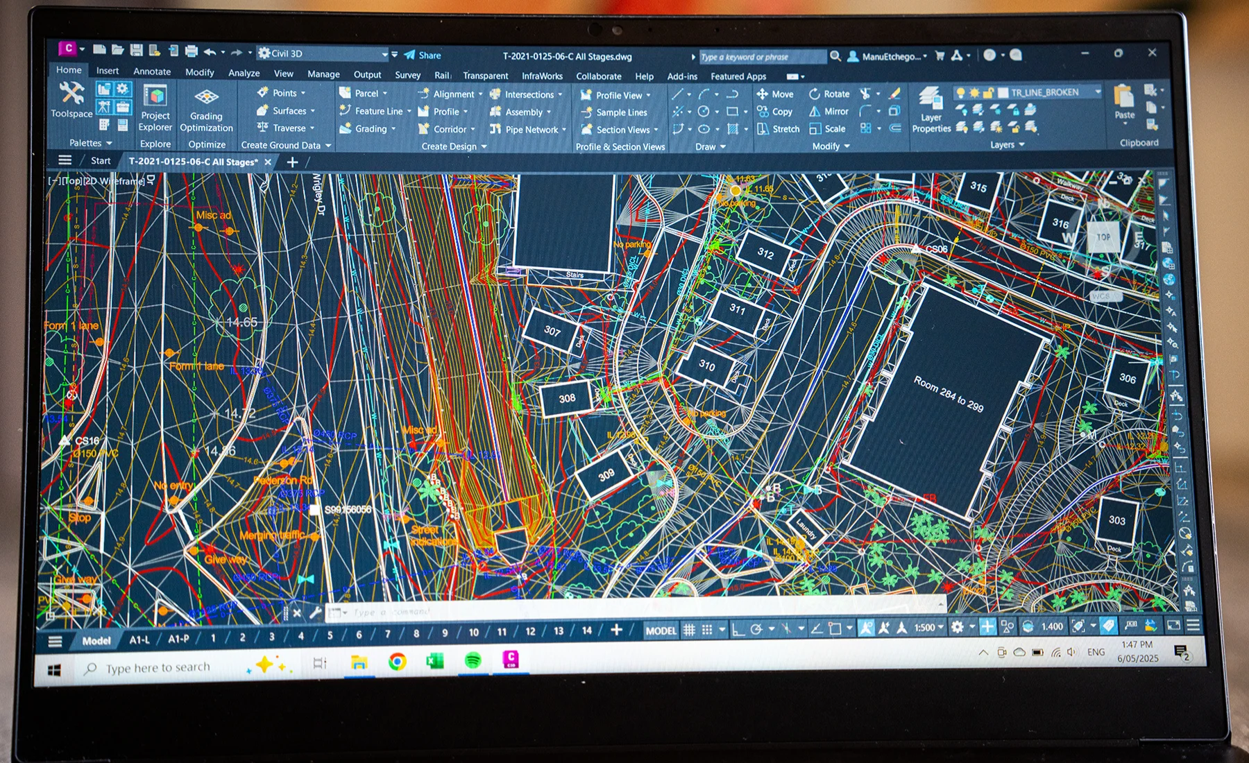
The professional Property Line Survey specialise in a broad range of land surveying services, catering to residential, commercial, and government sectors. Whether it’s boundary surveys, construction setouts, or land assessments, reliable, precise results are provided to guide critical decisions for developers, builders, and government agencies alike.


Accuracy and Reliability
Territory Surveys Pty Ltd is known for its team of diverse professionals who assess and provide expert guidance on land, building, and property matters, ensuring informed decisions and accurate results.
Our Mission
To enhance land ownership clarity through precise, timely, and professional surveying services that empower informed decisions and facilitate responsible development.
Our Vision
To be the leading name in land surveying across the Northern Territory. We aim to be valued for our accuracy, trusted for our reliability, sought after for our innovation, and chosen for our client-focused approach in every project we undertake.
Precision in Every Measure
Expert knowledge of the NT landscape.
Dedicated to delivering reliable results.
Committed to excellence at every stage.

Frequently Asked Questions
A property line survey helps you understand your land before starting any project.
- Planning construction or renovations near property boundaries
- Installing fences, retaining walls, or other structures
- Buying or selling property to confirm exact boundaries
- Suspecting encroachments from neighbouring land
- Preparing for subdivision or development approvals
Getting a property line survey ensures you know your boundaries, avoid disputes, and make informed decisions.
Territory Surveys provides a thorough process to accurately define your property boundaries.
- Researching historical title deeds, previous surveys, and council records
- Locating existing boundary markers, monuments, and reference points
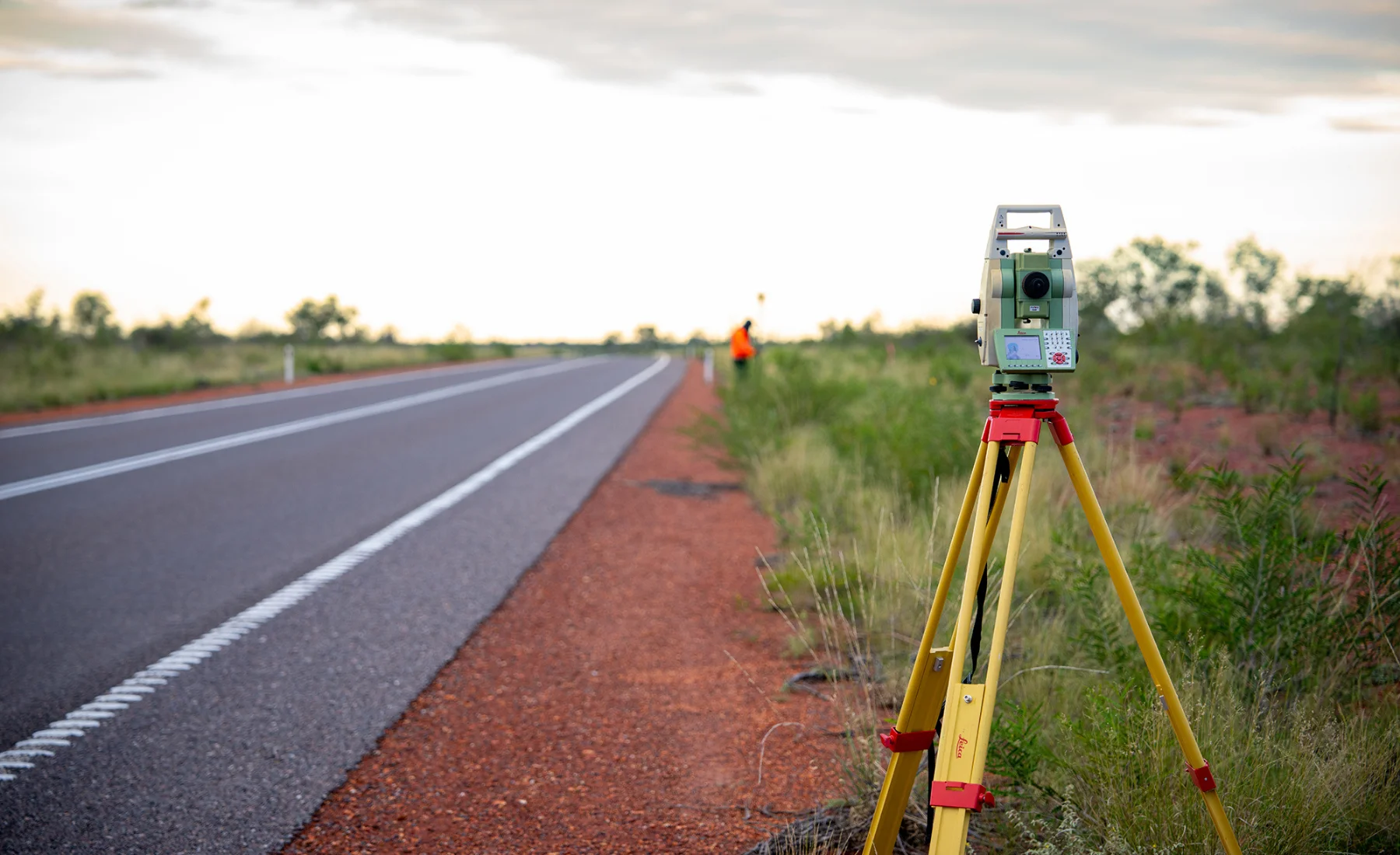
- Measuring distances, angles, and mapping the property accurately
- Re-establishing missing or disturbed markers according to legal standards
- Preparing a detailed survey plan showing boundaries, corner markers, encroachments, and site features
- Providing guidance on compliance with Northern Territory regulations
This service provides accurate information and guidance so your property planning or development is fully supported.
You will receive official records and reports that clearly outline your property boundaries.
- A detailed survey plan with accurate boundary lines, corner markers, and any encroachments identified
- Written reports summarising survey findings, recommendations, and marker positions
- Documentation suitable for council approvals, property transactions, building applications, or dispute resolution
- Records that can be used for long-term reference or future surveys
These documents give you a clear and official record of your property, supporting decisions now and into the future.
Surveyors use historical records, neighbouring surveys, and on-site measurements to locate missing markers. If necessary, they re-establish boundary corners according to legal standards and document them in your survey plan.
A survey provides strong legal evidence of your boundaries and reduces the risk of disputes. While it cannot guarantee that future changes on neighbouring properties or natural alterations won’t affect boundaries, it gives a solid reference point to resolve any issues.
The duration of a property line survey depends on property size, terrain, vegetation, and access. Simple residential sites may take a few days, while larger or more complex properties could take longer. Territory Surveys provides a clear timeframe after assessing your property.
You should consider updating your survey if:
- Previous surveys are old, unclear, or incomplete
- Property boundaries may have shifted over time
- Construction or development is planned
- Encroachment or neighbour disputes arise
- Council or legal documentation requires a current survey
Updating ensures your boundaries remain accurate, reliable, and legally recognised.